Snow quickly replaced by rain on Peninsula
Published 1:30 am Thursday, February 15, 2024


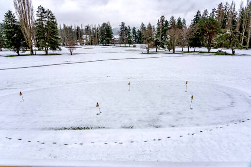
PORT TOWNSEND — Lowland snowfall on the North Olympic Peninsula ranged from a sprinkling to about 3 inches at some higher elevations and led to thousands of electrical outages early Thursday morning before precipitation turned to rain and melted away much of the white stuff.
A reported 3,016 Jefferson County Public Utility District customers — about 15 percent of the PUD’s service area — were without electrical power Thursday morning as the wet snow brought down tree branches onto power lines.
By 5 p.m., the number of customers without power was down to 668.
“(Crews) have been at it since 2 o’clock this morning,” said Jameson Hawn, communications specialist for the PUD, earlier in the day. “There’s a very good number of branches that have come down.”
Hawn said all the utility line crews were out working on clearing lines and restoring power, but it will likely be several hours before power is fully restored.
“It’s going to be an all-day event,” Hawn said Thursday morning, adding that regular updates would be posted to the PUD’s Facebook page.
“Avoid any line on the ground,” Hawn said. “We are seeing lines on the ground. Stay at least 50 feet away.”
The utility said some outages would likely continue into evening hours.
Areas particularly impacted by outages included South Point/Thorndyke; Quilcene/Leland; Beckett Point: Eaglemount/Gibbs Lake and Black Bear Road.
Clallam County PUD reported 120 outages Thursday morning, mostly in the Joyce area, where one resident reported getting about 2 inches of snow early Thursday.
In an email, PUD spokesperson Nicole Hartman said the other outages were scattered throughout the county.
“We’ve been having branches in the lines and trees falling,” Hartman said. “The crews are on it, but it has just been coming in small outages throughout the day.”
By 5:30 p.m., the number of outages had dropped to 11.
The National Weather Service recorded as much as 3 inches of snow in areas near the Hood Canal before rain moved in.
About 2 inches fell in the Joyce area with about a half-inch in Port Angeles near sea level and up to about 1 inch at higher Port Angeles elevations.
Little or no snow was recorded in the Forks area, according to the National Weather Service in Seattle.
Thursday’s snowfall was unlikely to contribute much to the Olympic Mountain snowpack, which has been well below the 20-year average, according to the U.S. Department of Agriculture.
USDA reported the Waterhole SNOTEL site near Hurricane Ridge gained several inches of snow since early morning Thursday — up from 18 inches at midnight to 21 inches as of 6 a.m. — still well below the seasonal average.
The Quilcene School District canceled classes for the day due to the weather while other Peninsula districts in the area remained open or operated on delayed schedules.
The snow turned to rain by midday as temperatures rose.
“It’s going to be dry going into the weekend mostly,” said Kayla Mazurkiewicz, a meteorologist with NWS.
Mazurkiewicz said cold air from the east was trapped along the Olympic Mountains and mixed with local precipitation, creating the wintry mix of snow and rain falling across Western Washington, particularly along the Hood Canal.
Overnight lows are expected to rise in the coming days, and the weekend should see scattered rain showers, according to the NWS.
________
Reporter Peter Segall can be reached at peter.segall@peninsuladailynews.com.


