Second storm this week roars into east, west sides of Peninsula
Published 1:30 am Thursday, October 19, 2017
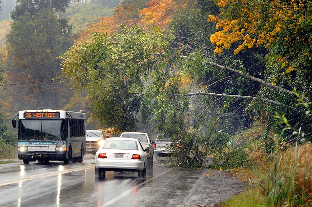
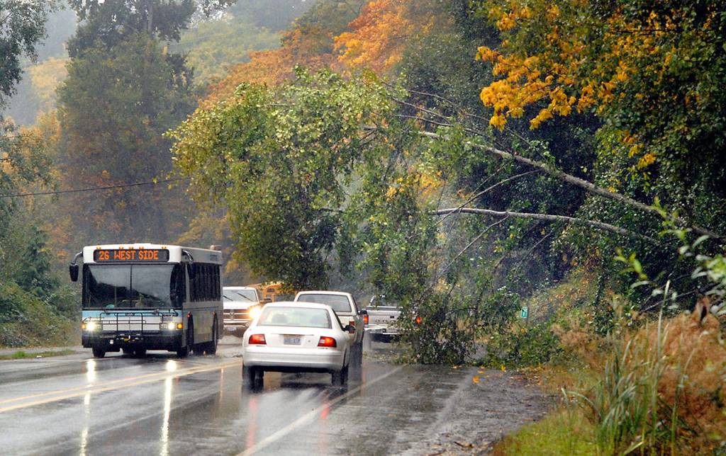


Hundreds of customers lost power Wednesday as wind and rain moved through the North Olympic Peninsula.
Winds gusted to 54 mph at Point Wilson in Port Townsend and to 44 mph at Quillayute Airport near Forks, according to National Weather Service observations.
A pronounced rain shadow spared Port Angeles and Sequim from the worst of the wind and rain before the warm front moved through in the afternoon, said Ni Cushmeer, a meteorologist with the National Weather Service in Seattle.
The Clallam County Public Utility District reported that 740 customers lost power in Neah Bay, 700 went dark in the Diamond Point area and about 250 had outages in the Forks area.
Power was restored to Diamond Point at 12:49 p.m. Neah Bay had power back on at 2:18 p.m. Power remained out in Forks as of 4:32 p.m.
There were smaller outages on Buckloop Road near Sequim and Hoko-Ozette and Lower Hoh roads on the West End, Clallam County PUD spokeswoman Nicole Clark said.
Some 600 Jefferson County PUD customers lost power in Discovery Bay and Gardiner on Wednesday, PUD spokesman Will O’Donnell said.
“We got that restored,” O’Donnell said at 2:45 p.m.
“Right now, we’ve got just over 200 down in the Quilcene area that we’re working on.”
Smaller, scattered outages were reported throughout the day in East Jefferson County, including one at the Port Townsend paper mill, O’Donnell said.
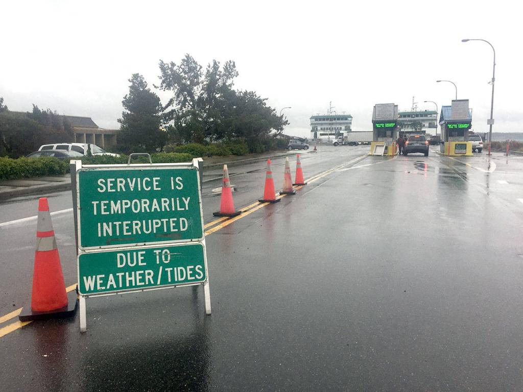
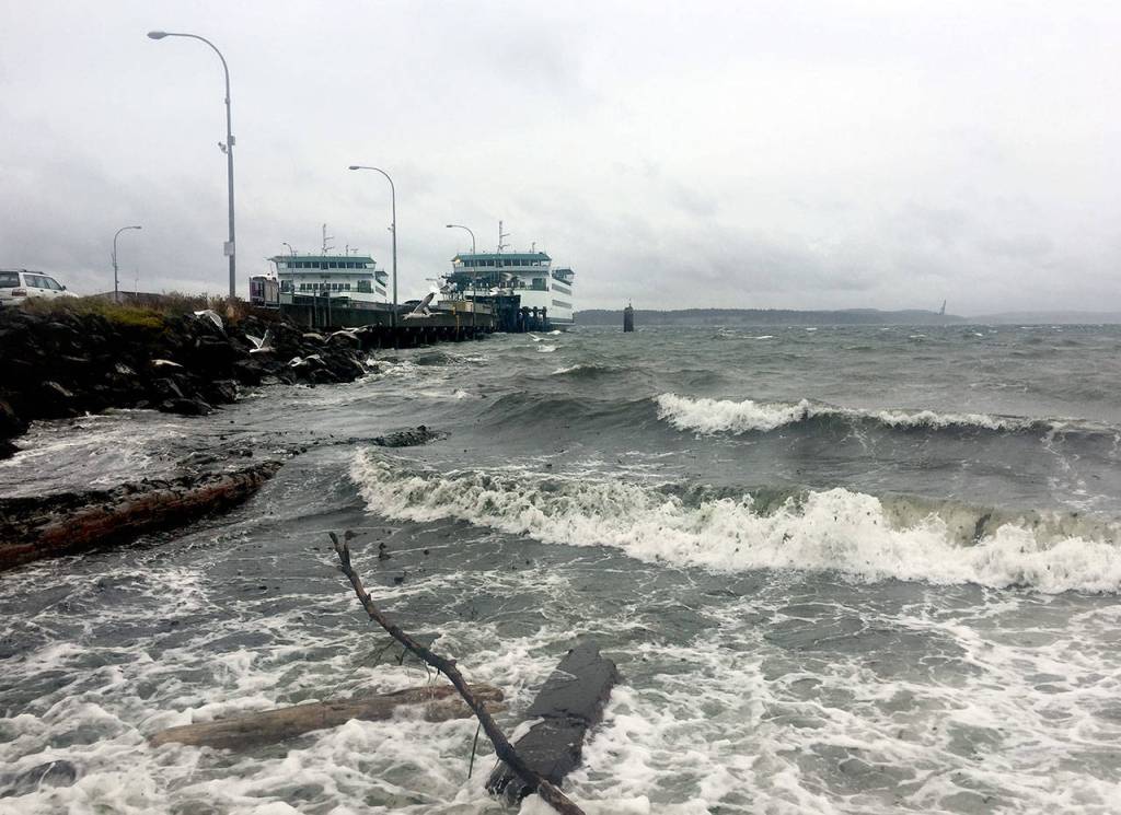
The Port Townsend/Coupeville ferry stopped sailing Wednesday because of high wind and waves.
Meanwhile, the highest wind gust at William R. Fairchild International Airport in Port Angeles was just 8 mph.
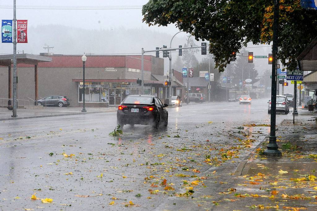
Forks had 2.77 inches of rain as of 4:53 p.m. Port Angeles had 0.85 inches of rain at the same time. Most of that precipitation fell in the afternoon.
Sequim had 0.21 inches of rain and Port Townsend had 0.06 inches as of 4:55 p.m., according to unofficial observations.
The series of storms — the first of the season — began Tuesday with wind gusts and rainfall.
North Olympic Peninsula rivers were running well above average but were not expected to flood.
The National Weather Service said minor flooding was possible on the Skokomish, Nooksack, Skagit and Stillaguamish rivers.
Olympic National Park reported heavy rain and a 43-degree temperature at Hurricane Ridge. The peak gust at the ridge was 62 mph, park officials said.
Showers are forecast for the North Olympic Peninsula lowlands today and Friday.
A high surf advisory will be in effect through 6 a.m. Friday for a west swell of 18 to 21 feet.
Heavy rain is expected to return to the region Saturday.
The rain shadow will be less pronounced for the North Olympic Peninsula on Saturday than it was Wednesday because the next system is tracking from the west rather than southwest, Cushmeer said.
A rain shadow is formed when air sinks and dries on the leeward side of the Olympics.
“You guys could get quite a bit of rain,” Cushmeer said.
“The flow is strongly out of the west.”
________
Reporter Rob Ollikainen can be reached at 360-452-2345, ext. 56450, or at rollikainen@peninsuladailynews.com.