Storm raises hopes about clearing smoky air
Published 1:30 am Thursday, September 17, 2020


North Olympic Peninsula air quality expectations heading into the weekend are hazy yet hopeful as a storm off the coast prepares to move inland today.
“Thursday into Friday will be our first shot at starting to clear the air,” said meteorologist Mary Butwin in the National Weather Service’s Seattle office, adding that a second storm front is due to arrive next week.
The Weather Service, with input from regional air-quality agencies, will decide today whether to extend its smoke alert, which was initially extended Monday and is due to expire at noon today.
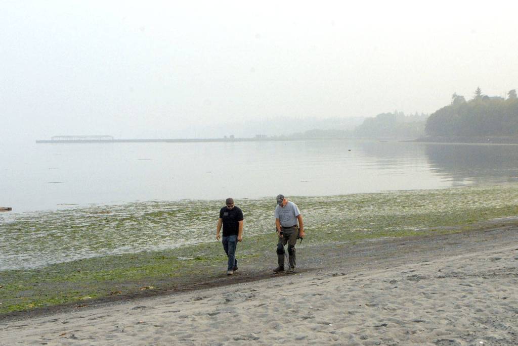
Heavy smoke from wildfires in California and Oregon filled western Washington late last week, causing unprecedented hazardous air-quality conditions on the Peninsula that blocked out the sun and lasted well into the week.
While air quality in the region has improved to unhealthy if not very unhealthy in the past two days — due in part to spotty rain showers — it’s unclear how much relief today’s coming storm will bring.
“The storm coming through later on Thursday has some rain and will certainly help air-quality conditions, but probably not too much,” Butwin said. “We’re confident air quality will get better but not sure how much better.”
While smoke persisted, the Peninsula briefly saw patches of blue sky and bright sunshine Tuesday. In Port Townsend on Wednesday, a vague outline of islands across the bay could be seen for the first time since late last week.
As of Wednesday afternoon, Port Angeles had a pollutant count of 212, putting it in the very unhealthy category, while Port Townsend straddled the line between unhealthy and very unhealthy with a pollutant count of 200, according to the state Department of Ecology’s Air Quality Advisory scale.
Those figures represent a measurement of particles in the air under 2.5 microns in size measured in micrograms per cubic meters.
Hazardous is anything over 300, while 201-300 very unhealthy, 151-200 is unhealthy and 101-150 is unhealthy for sensitive groups.
Those figures fell slightly Wednesday from Tuesday due to pop-up rain showers Tuesday night, Butwin said. However, winds began blowing from the south Wednesday, threatening to bring more smoke into the region ahead of today’s storm.
“Between Friday and this other system coming next week, we’re not sure how well it will push the smoke out,” Butwin said, noting that today’s storm will also bring along some smoke that’s been hanging around off the coast since last week. “Whatever smoke is out there will be pushed in first.”
Another factor is how long that storm hangs over western Washington before continuing east, she said. Once it moves on, more southerly winds could fill the gap.
“Sunday is still looking better than current conditions because we’ll have that good westerly flow during that time,” she said, “but we’re really not sure how long that’ll last.”
________
Jefferson County senior reporter Nicholas Johnson can be reached by email at njohnson@peninsuladailynews.com.