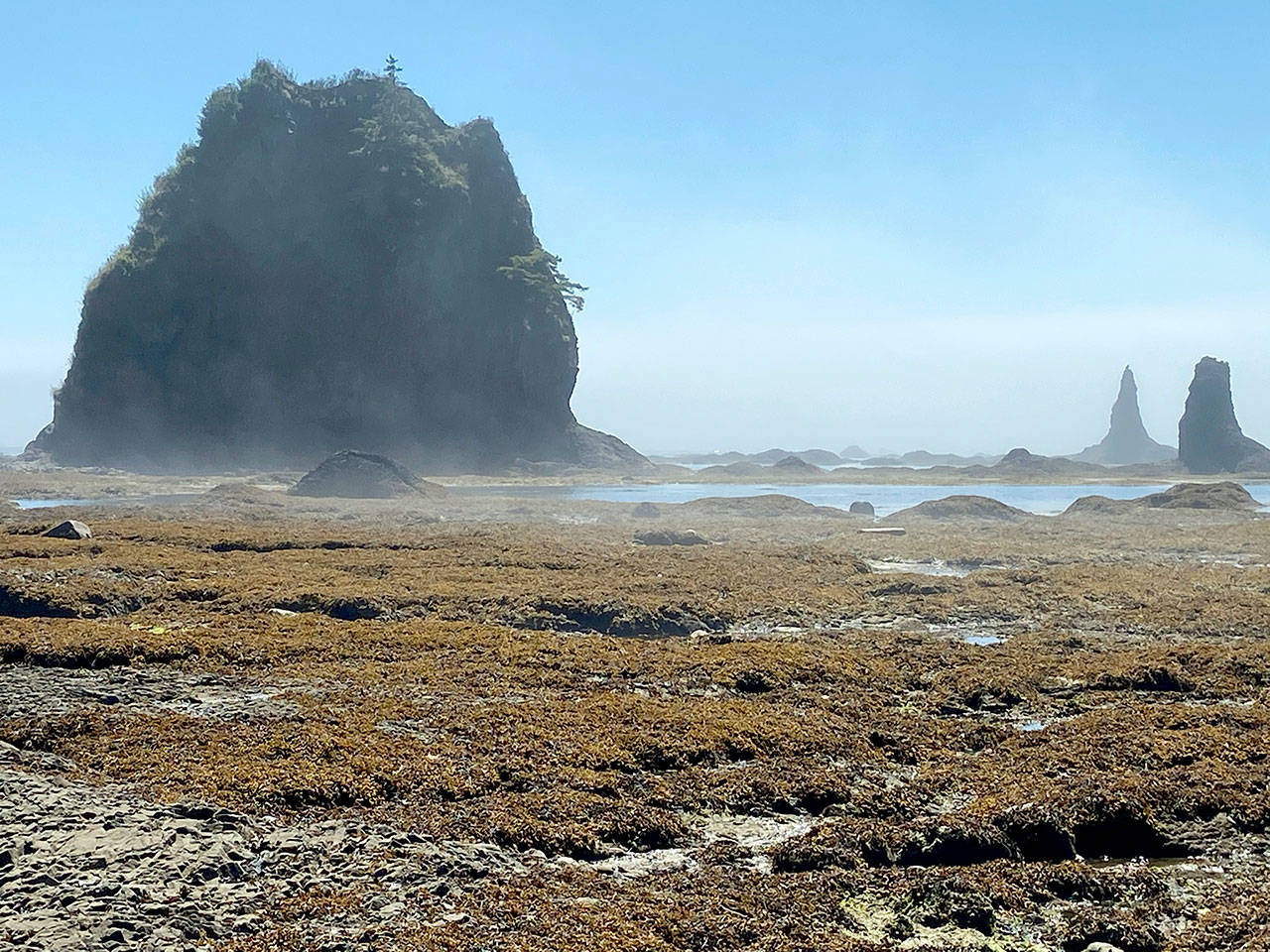
OLYMPIC NATIONAL PARK — Towering sea stacks, ancient petroglyphs and a bear with two cubs were found on the Cape Alava loop.
The 9.4-mile hike, also known as Ozette Triangle, touches the westernmost point in the contiguous United States near the famous Ozette archaeological site.
The wild and scenic coastline south of Cape Alava was home to the Makah Tribe from time immemorial.
It is now within Olympic National Park’s coastal strip and can be accessed from a trailhead at the northern tip of Lake Ozette.
Petroglyphs of whales and other sacred tribal symbols were carved centuries ago at Wedding Rocks, one of several highlights of the mostly flat triangular circuit through forests, prairies and undisturbed coastline.
Hikers and campers can choose one of two boardwalk trails to the Pacific Ocean and return on the opposite trail to form a clockwise or counterclockwise loop.
The 3.1-mile northern route goes through old growth forest and the Ahlstrom Prairie, named for Swedish homesteader Lars Ahlstrom, to Cape Alava.
The 3-mile southern route, built by the Nylund family in 1927, was used by Scandinavian settlers to move provisions from a small warehouse on Sand Point to Lake Ozette, according to Judy Bentley’s “Hiking Washington’s History.”
Both trails crest a gently-sloping hill on a series of boardwalks, some with missing planks. They are connected by a spectacular 3.1-mile coastal segment that features acres of tide pools and myriad sea stacks.
The rocky coastline can be navigated with relative ease at medium or low tide by negotiating logs, boulders and tide pools. High-tide routes are available at two pinch points along the rugged coast.
Our southerly progress was interrupted Saturday when a bear with two cubs moved onto the beach near Sand Point.
The adult bear spent about 45 minutes digging in sand and seaweed while her cubs found shade in nearby vegetation.
The encounter was consistent with other recent bear sightings at Sand Point as reported in online forums.
Olympic National Park provides information about black bears at www.nps.gov/olym/learn/nature/black-bear.htm.
Back at Cape Alava, a three-quarter-mile detour north of the Ozette Triangle leads to Tskawahyah, also known as Cannonball Island, and a small replica longhouse at the Ozette village site.
Tens of thousands of priceless Makah artifacts were uncovered from the Ozette dig in the 1970s. The artifacts were preserved in a 450- to 550-year-old landslide that buried six longhouses, according to the tribe’s website.
Storm erosion exposed one of the longhouses in 1970. The tribe reached out to Washington State University archaeologist Richard Daugherty, who led an 11-year excavation that produced more than 55,000 artifacts and captured a snapshot of life in the village at the time of the landslide.
Many of the artifacts from the Ozette dig are displayed in the renowned Makah Cultural & Research Center Museum in Neah Bay.
The Makah museum and all other tribal facilities, including Cape Flattery and Shi Shi Beach trails, remain closed because of COVID-19 precautions.
The Ozette site became known as the “American Pompeii” because of how well the 10-foot-thick layer of mud preserved the longhouses and their contents, according to the Society of Architectural Historians.
A memorial to the site, spelled “Osett,” is housed inside the replica longhouse just north of the abandoned Makah-Ozette Ranger Station.
“Generation to generation our people have shared the wealth from the land and the sea,” the Osett memorial reads.
“From this site we have gained appreciation of the wisdom of our forefathers. From this we gained new strength.”
_______
Reporter Rob Ollikainen can be reached at rollikainen@peninsuladailynews.com.

