
The North Olympic Peninsula dodged a bullet this time.
That’s what Ron Cameron, undersheriff and Emergency Management Division manager for Clallam County, said Thursday about the effect on Clallam and Jefferson counties of a storm that devastated much of the nation.
The National Weather Service had alerted the Clallam County Department of Emergency Management before the snow hit on Wednesday to the potential for this system to bring over 8 inches of snow to the Peninsula lowlands, he said.
“That just never happened,” Cameron said. “We seem to have dodged a bullet … We monitored the roads this morning and we’re keeping an eye on what’s to come.
“The problem is, it’s so hard to predict our weather.”
The Peninsula is unique when it comes to weather predictions due to a series of microclimates, which mean the weather in one area can vary greatly with another, even one close by.
“It could be coming down in Forks and bone dry and sunny in Port Angeles,” Cameron said.
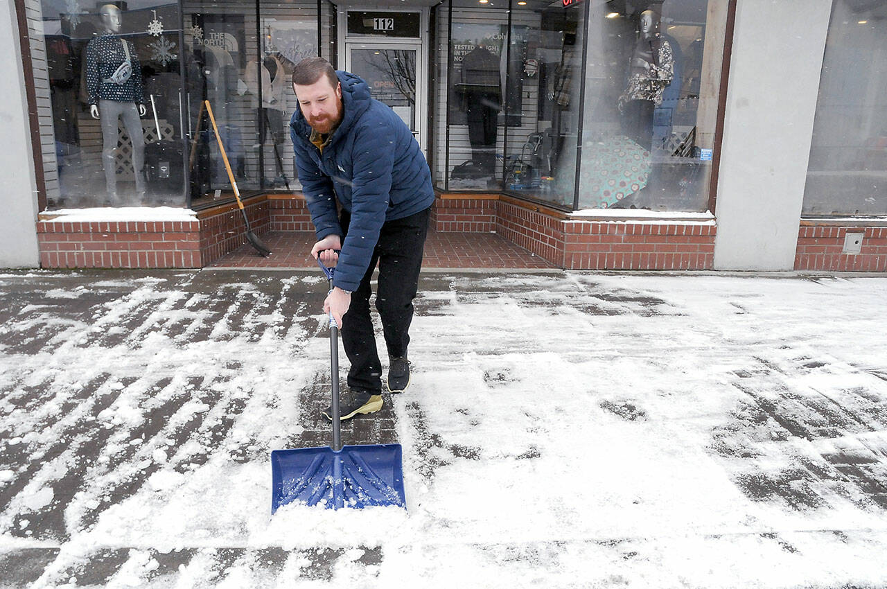
Ice, much more than snow — which ranged from a sprinkling to no more than a couple of inches on the Peninsula — was the problem for motorists on Thursday.
Icy road conditions prompted the closures Thursday of Port Angeles and Joyce’s Crescent public school districts as well as Peninsula College. Sequim, Quillayute Valley in Forks and Chimacum school districts announced two-hour delays to the school day to allow for the roads to warm up and be treated by local, county and state maintenance crews.
Port Angeles Public Works crews were out Wednesday night and Thursday morning, salting and sanding icy roads.
Clallam County Sheriff’s deputies responded to a few wrecks related to road conditions in the early morning hours, but none were significant, Cameron said.
“I didn’t hear of any overwhelming incidents in the county,” he said. “I did hear about icy roads in the City of Port Angeles Wednesday night, but it sounds like the police and city utilities were able to handle it.”
Port Angeles seems to have borne the brunt of this first system as other areas on the Peninsula reported passable roads.
“These last few days, we have used a combination of salt and the natural warming of the roads during the day,” said Matt Stewart, Jefferson County road maintenance supervisor.
“We have pleasantly been treated to some relatively warm air temperatures during the afternoon, but more than that, pretty warm road temperatures, which is helping to melt everything out.”
Stewart said the plows went out in Jefferson County at about 3 a.m. Thursday and that the early plowing and salting limited the amount of ice on the roads.
“We started the melting process with salt this morning, and we were really able to clear things up before we head into another freezing night,” Stewart said.
The state Department of Transportation also had its crews out overnight, taking care of federal and state roads.
“I know our maintenance crews that are based in Port Angeles, Discovery Bay, Forks and Seiku have been out treating the state roads and plan on continuing that work throughout the weekend and through this weather event,” said April Leigh, communications and outreach supervisor for DOT.
Jefferson Transit Authority changed the No. 1 Brinnon Route, saying it would not serve Black Point or Triton Cove due to a lack of connection with Mason Transit and that the bus would hold at Quilcene Community Center before returning to Port Townsend. In addition, the No. 8 Sequim Route would not service the Tribal Center stops.
Clallam Transit was running its regular routes but noted that passengers should expect delays due to the weather.
No electrical outages were reported due to the weather.
Winter weather is expected to continue on the Peninsula through the weekend with a potential shift to warmer temps and rain early next week.
Meteorologists with the National Weather Service said snowfall would ease today but that another system is likely to move in over the weekend.
This system will bring in slightly warmer temperatures, above 40 degrees during the day, with cooler temps at night, which could increase the chances of icy roads in the early morning hours.
“Everything should be drying out throughout today and into tomorrow, but the cold temperatures will probably stay in the mid to upper 30s, at least through Friday and into the weekend,” said meteorologist Kayla Mazerkiewicz of the National Weather Service in Seattle.
“We will slightly warm up over the weekend, but then another system will move in from the north where we will probably see some rain and snow mix as the low-level cold air still remains,” she said.
“Going into next week, the temperature will start to warm up and we should see a transition to rain.”
This brutal winter storm has impacted most of the nation on some level, with whole interstates and airports shutting down, and more than 16,000 flights have been canceled due to the snow, ice, wind and cold temperatures.
Some areas of the country are experiencing record-breaking weather events such as the city of Portland recording over 10 inches of snow in its metro area or the blizzard warning being issued for southern California for the first time in more than 30 years.
________
Reporter Ken Park can be reached at kpark@peninsuladailynews.com.
