
GETTING LOST AND disoriented in the mountains is surprisingly easy to do.
Living here on the Olympic Peninsula, it’s not unusual to hear of lost or missing hikers.
Thankfully, most are found alive and well. Some are found after a few days missing and, occasionally, some are never found.
According to the National Park Service the total number of search and rescue incidents in Olympic National Park from January through September this year is 77. This is why park visitors are urged to tell someone where they are going and to always pack the 10 essentials even if they’re planning a day hike or ride.
No. 1 on the National Park Service list to carry with you at all times are navigation tools such as a map, compass and, hopefully, a GPS system.
When I was younger, I loved to head out alone on my horse for a long day trail ride in the mountains.
I found many trails that were not well marked or abruptly came to a dead end, and quickly learned how easy it is to get lost.
Sometimes, I would turn around thinking I would take the same trail back only to find there were many more forks in the trail than I remembered and I’d get lost.
While I always found my way back home, more than once it was way past dark and I’d be shivering cold.
After the second time this happened, I began carrying extra jackets, gloves, water and snacks for myself, horse and dog (both who knew the way back better than I did).
That was pre-cellphone era. Now, of course, I always have my cellphone carried in a pouch attached to my belt.
The rest of the list includes:
2. Insulation: jacket, hat, gloves, rain shell and thermal underwear.
3. Sun protection: such as hat, sunglasses and sunscreen.
4. Illumination: flashlight, lanterns and headlamp, and matches.
5. First-aid kit.
6. Fire: matches, lighter and fire starters.
7. Repair kit and tools: duct tape, knife, screwdriver and scissors.
8. Hydration: water and water treatment supplies.
9. Emergency shelter: tent, space blanket and tarp.
10. Food: provisions for at least a few days.
On the horse I include a sharp knife, foldable saw and, when they’re out, wasp spray.
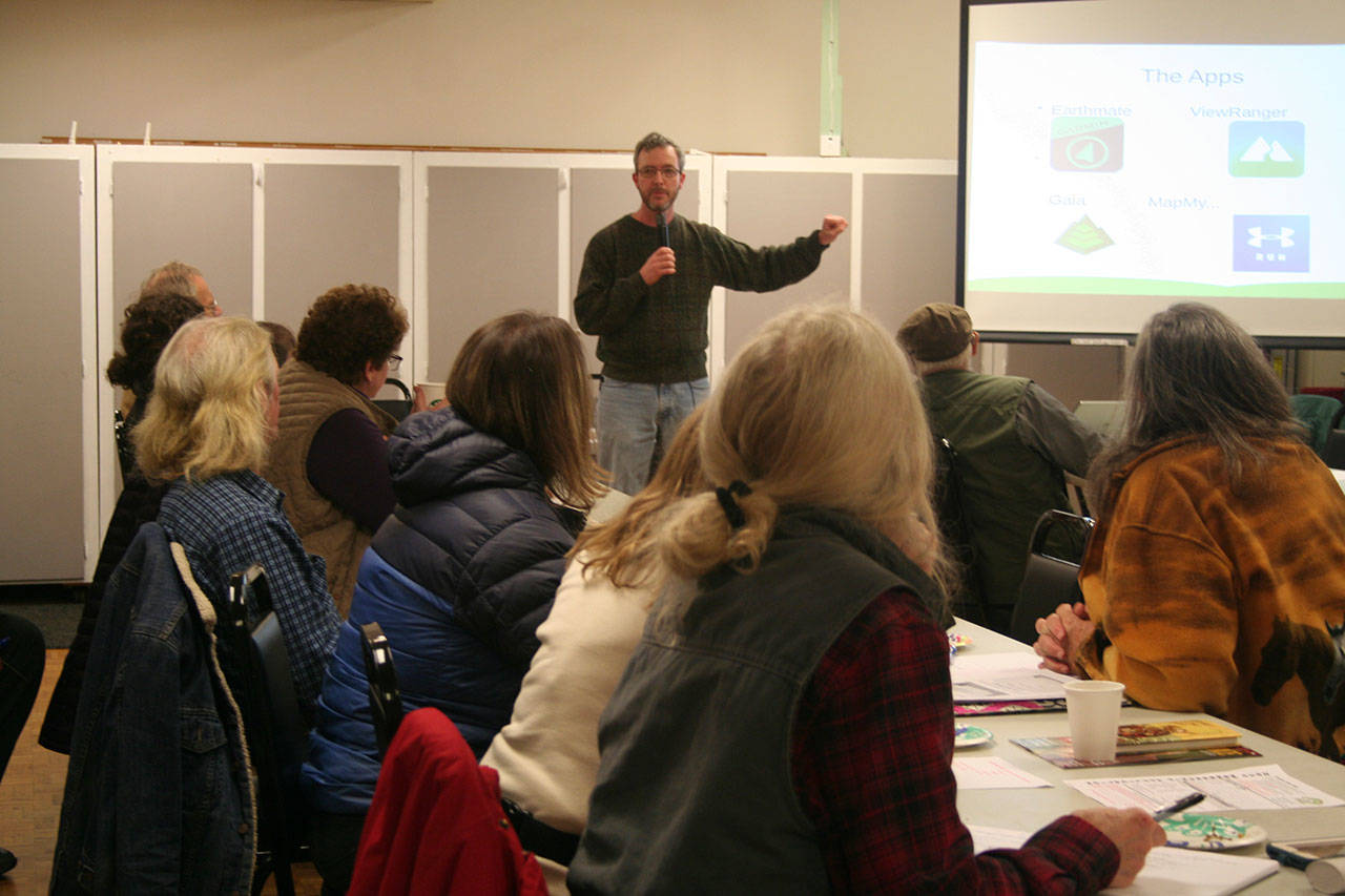
Knowing a reliable handheld GPS unit can be a lifesaver is the reason why the Buckhorn Range Chapter of Back Country Horsemen was excited to invite Daniel Heaton, Port Townsend library’s technical services manager, to its November monthly meeting to explain how GPS works and talk about some of the apps available to use with your cellphone.
I, too, wanted to learn more so I decided to attend the meeting held at the Tri-Area Center in Chimacum.
Heaton offered the group a handout on some websites to find more information and gave a slide show presentation in which he reviewed the GPS apps he’s familiar with and has used on his hiking and backpacking trips: Garmin’s Earthmate, ViewRanger, Gaia and the various MapMyRun/ride/walk/hiking apps.
Some cellphone GPS apps are free, some need to be purchased with a one-time fee and others require a monthly subscription in order to access all of the features that come with them.
Before spending money I encourage trying the free version, and to also read the reviews.
If you find the app fits your needs then you might want to purchase the full version.
Heaton said first off ask yourself what your needs are: Do you want an app to track fitness (like a pedometer) and health? The iPhone Apple Health covers that. Do you want it for navigation and tracking in the mountains? For that, you might want to invest in a hand-held GPS unit that doesn’t depend on cell towers and cellphone coverage.
Also, especially if you enjoy hiking alone, it’s good to carry a GPS device that includes an emergency communication device that doesn’t rely on cellphone service.
GPS
What is GPS? GPS, or Global Positioning System, was developed by the U.S. Department of Defense.
GPS uses a constellation of satellites that send location and timing data from space directly to your phone. If the phone can pick up signals from three satellites, it can show where you are on a flat map, and with four, it can also show your elevation.
But no two handheld GPS receiving units are exactly alike. In fact, even different models from the same manufacturer vary in style and functionality to some degree.
While all handheld GPS units serve to find and track your location, different manufacturers include different features based on a variety of use cases.
At any given time, there are at least 24 active satellites orbiting more than 12,000 miles above earth.
The positions of the satellites are constructed in a way that the sky above your location will always contain at most 12 satellites.
Purpose of satellites
The primary purpose of the 12 visible satellites is to transmit information back to the Earth over radio frequency (ranging from 1.1 to 1.5 GHz). With this information and some math, a ground-based receiver or GPS module can calculate its position and time.
GPS accuracy depends on a number of variables, most notably signal-to-noise ratio (noisy reception), satellite position, weather and obstructions such as buildings and mountains.
These factors can create errors in your perceived location. Signal noise usually creates an error from around one to 10 meters. Mountains, buildings and other things might obstruct the signal.
If the GPS receiver’s antenna can see at least four satellites, it can accurately calculate its position and time. This is also called a lock or a fix.
Carriers can now send that data over a cellular or Wi-Fi network, which is a lot faster than a satellite link. This might cut GPS startup time from 45 seconds to 15 seconds or less, though it’s still unpredictable.
With such a cache of satellite data on board, a phone often can identify its location in two seconds or less, Heaton said.
Find three satellites
All the technologies that speed up GPS still require the phone to find three satellites.
Most smartphones now come with three inertial sensors: a compass (or magnetometer) to determine direction, an accelerometer to report how fast your phone is moving in that direction and a gyroscope to sense turning motions. Together, these sensors can determine your location with no outside inputs, but only for a limited time
For more information on how GPS works, Heaton provided the links tinyurl.com/PDN-Know-Where-You-Are and tinyurl.com/PDN-GPS-Basics.
The bottom line is to plan for the unexpected. Tell others where you’re planning on going and when you’ll return. Include a note of your plans in your parked car. Tell the park rangers in advance of your plans, too. And always carry the 10 essentials with you.
________
Karen Griffiths’ column, Peninsula Horseplay, appears the second and fourth Sunday of each month.
If you have a horse event, clinic or seminar you would like listed, please email Griffiths at kbg@olympus.net at least two weeks in advance. You can also call her at 360-460-6299.
